Skip to content
Ufopa coat of armsFederal University of Western Pará
LabMet Meteorological Instrumentation · Ufopa
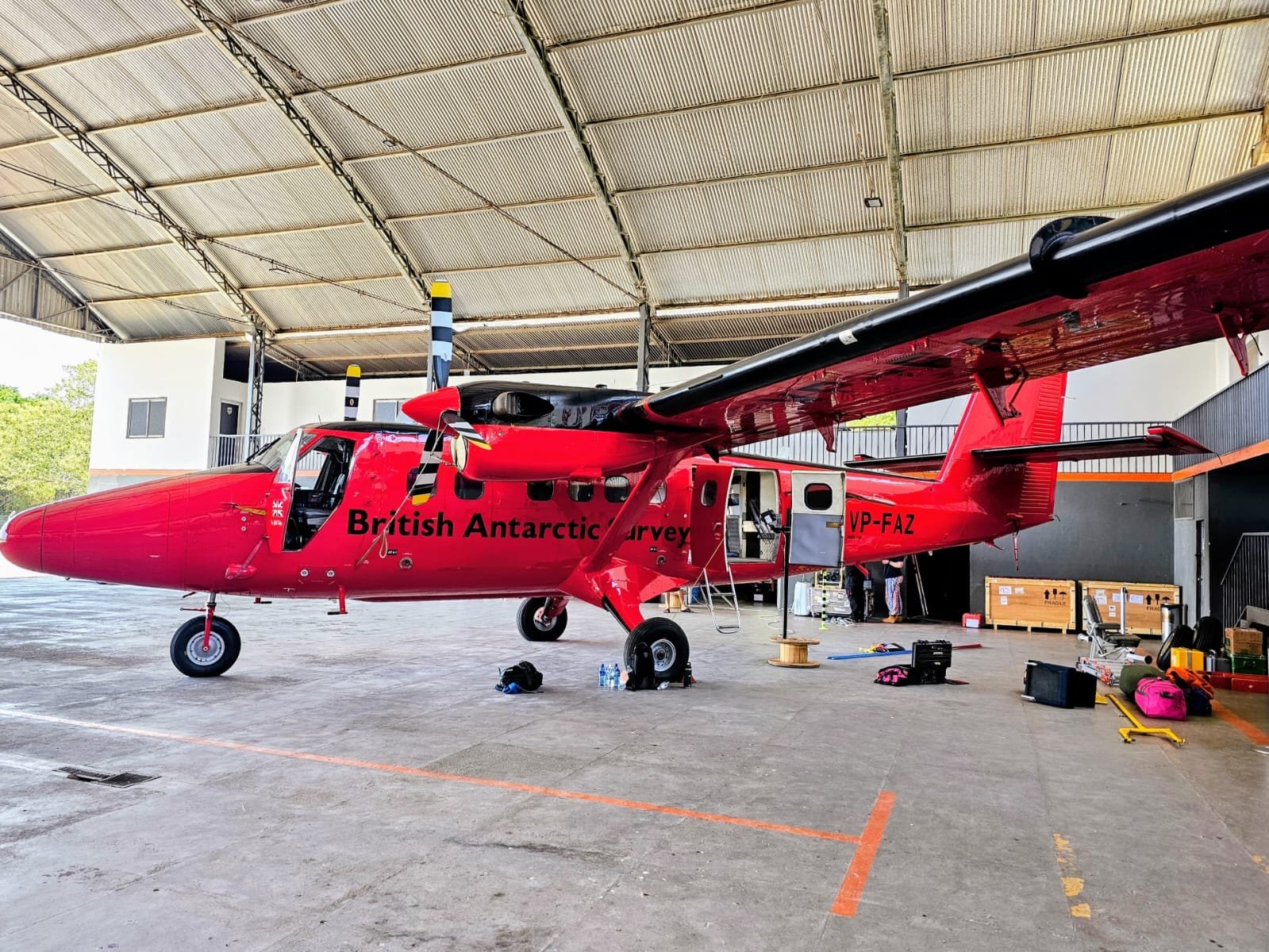
Red British Antarctic Survey research aircraft inside a hangar in Santarém

Home / Projects

CarbonARA-Brazil

Is the Amazon rainforest still removing carbon from the atmosphere, or does it now emit more than it absorbs? The project is measuring the answer around Santarém.

Photo: ESA, CarbonARA project

The project

Direct measurements where there are now only estimates

There are signs that the Amazon's capacity to absorb carbon is declining because of deforestation, forest degradation, droughts and fire. Some areas may already emit more than they absorb. Current estimates rely heavily on satellites and models, and there are too few direct measurements to check them.

The Committee on Earth Observation Satellites (CEOS) identifies the Amazon as a possible tipping point for carbon emissions and has called for a large-scale field experiment in the region. CarbonARA (Carbon Amazon Rainforest Activity) is the response to that call.

The project brings together ground, airborne and satellite measurements over a 100 by 100 km area around Santarém, which includes primary forest, secondary forest, farmland and degraded land.

It is funded by the European Space Agency (ESA) and led by King's College London. In Brazil, it is carried out by the National Institute for Space Research (Inpe) under the GAS-AMZ project, coordinated by Luiz Aragão. Ufopa is the only university from the Amazon region in the consortium and is responsible for coordinating activities on the ground, with Professor Julio Tota as local coordinator.

Our main scientific interest is to understand how measurements taken from the ground up and from the sky down fit together, so that we can monitor fires and their emissions in three dimensions.

Julio Tota, the project's local coordinator, in an interview with Ascom/Ufopa

How we measure

Three ways of observing the same area

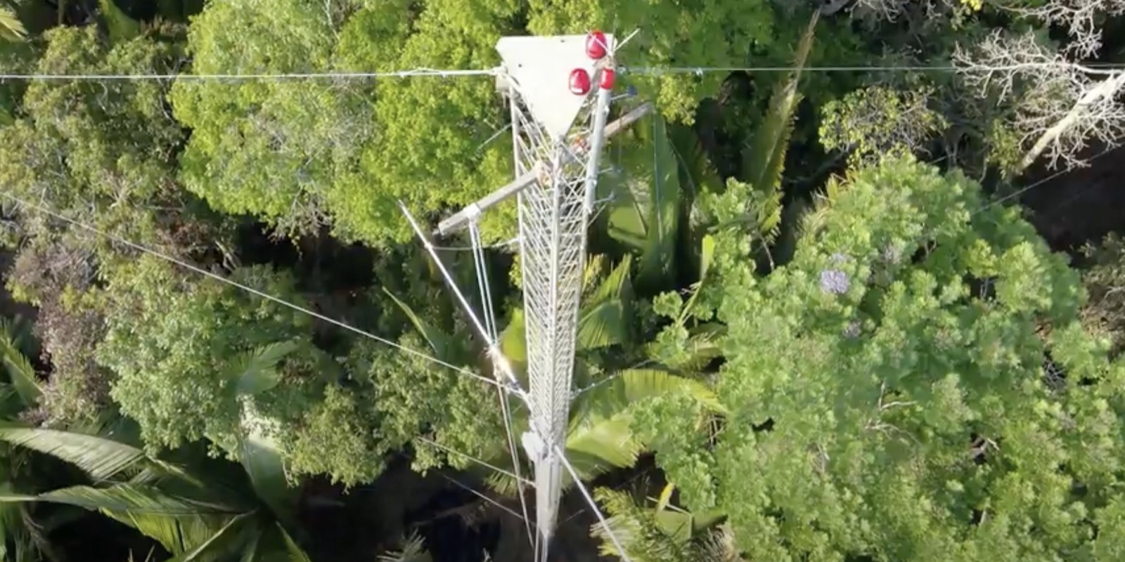
Top of a tower with instruments above the tree canopy

On the ground

Two fixed tower measurement sites, one in primary forest and one in secondary forest, plus air quality and smoke sensors at nearby locations such as schools.

Mobile teams with drones travel to fire hotspots flagged in real time by satellites.

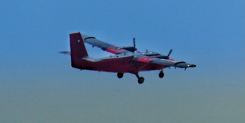
Red twin-engine aircraft in flight

In the air

A British Antarctic Survey Twin Otter aircraft flew over the Tapajós National Forest, the Experimental Farm, deforested areas and active fires between late September and late October 2025.

Around 55 flight hours were planned, in 15 legs of 4 hours.

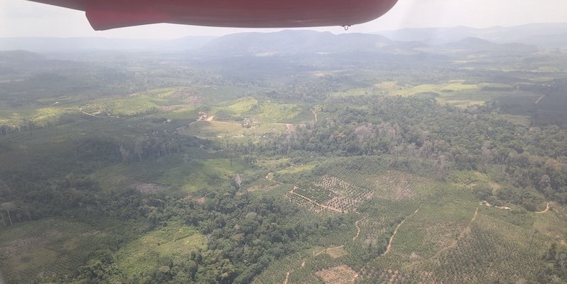
Secondary forest and open land seen from the aircraft window

From space

Satellites from ESA and other agencies pass over the area while the aircraft and towers are taking their measurements.

The comparison shows how accurate the orbital measurements are and helps to correct climate models.

Science

What the project investigates

The measurements are organised into three themes.

1. Greenhouse gas fluxes across the landscape

How much CO2, methane and nitrous oxide each type of land cover exchanges with the atmosphere, without the influence of fire. The aim is to reduce the uncertainty of these estimates for the Amazon.

2. Vegetation processes and carbon stocks

How the forest functions over the day and across the seasons. The towers measure evapotranspiration and solar-induced vegetation fluorescence, a signal of photosynthesis that can also be observed by satellite.

3. Fire: intensity, emissions and impact

What fires emit in each vegetation type and season, including greenhouse gases, other reactive gases and particulate matter. The aircraft samples high smoke plumes that cannot be reached from the ground or by small drones. The data also show what satellites miss and help to assess the effect of smoke on air quality and health.

The results are also used to validate data from operational satellites, such as Sentinel-2, Sentinel-3 and Sentinel-5P, and from new or planned missions, such as BIOMASS, FLEX and CO2M.

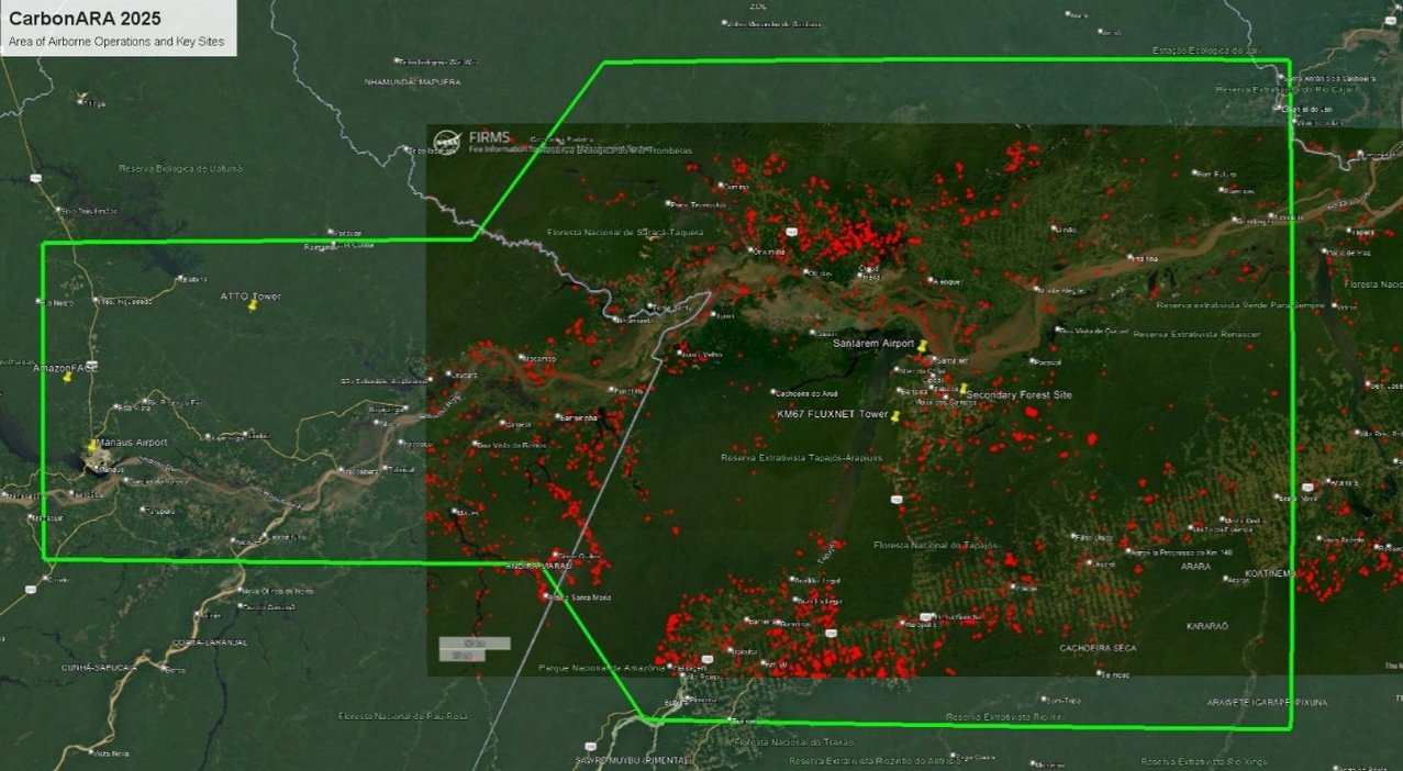
Satellite image of the region between Manaus and Santarém showing the outline of the flight area, fire hotspots in red and the locations of the towers and Santarém airport
Operating area of the airborne campaign and measurement sites. The red dots are fire hotspots detected by satellite. Image: ESA, CarbonARA project.

In the field

Measurement sites

Ufopa Experimental Farm, secondary forest

The farm is at km 37 of the Santarém–Curuá-Una highway (PA-370) and covers about 660 hectares. In 2025 it received a 40-metre micrometeorological tower, assembled and installed under the coordination of Professor Julio Tota.

The site already hosted a SONDA network station (Inpe and Ufopa), which measures solar radiation and wind, and the Atmospheric Observatory, with an AERONET photometer that measures aerosols by day and night. This measurement is important in the dry season, when smoke from fires increases.

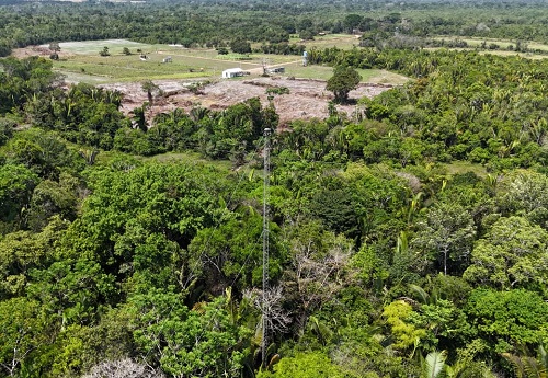
Aerial view of a narrow metal tower above the tree canopy, with open land in the background
40 m tower at the Experimental Farm. Photo: Avner Gaspar, Ascom/Ufopa.
New instruments at the Experimental Farm
InstrumentWhat it measuresResponsible
Open-path methane analyser (LI-COR)Methane concentration and fluxUfopa
IRGASON (Campbell Scientific)CO2, water vapour and energy fluxesUfopa
FloXSolar-induced vegetation fluorescenceJB Hyperspectral
Pandora spectrometerTrace gases in the atmospheric columnESA

Tapajós National Forest, km 67, primary forest

The Tapajós National Forest covers 450,000 hectares of upland (terra firme) forest. The km 67 site is part of the LBA programme and lies in a little-disturbed area, with emergent trees and many epiphytes.

The site has a 65-metre flux tower and a 45-metre tower with a staircase, managed by Ufopa, which received the campaign's new instruments.

Scientific sampling in the protected area is authorised by ICMBio.

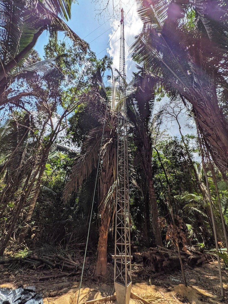
Lattice metal tower seen from below, among palm trees and tall trees
45 m tower in the Tapajós National Forest. Photo: ESA, CarbonARA project.
New instruments on the 45 m tower at km 67
InstrumentWhat it measuresResponsible
L-band radiometerVegetation optical depthTerraRadTech
FloXSolar-induced vegetation fluorescenceJB Hyperspectral
GNSS receiverVegetation optical depthESA
KT15.85 thermal radiometersSurface temperatureKing's College London

Airborne campaign

A laboratory flying 2.5 km above the ground

The Twin Otter first took off from Santarém airport on 26 September 2025. Most of the remote sensing was done at about 2.5 km above the ground, a height at which each image pixel corresponds to a few metres on the surface.

The aircraft acts as a magnifying glass for the satellites and, at the same time, shows whether what the towers measure holds for the surrounding landscape. It carries hyperspectral and thermal cameras to observe vegetation and fire and, to sample the air, analysers for gases and for particles such as soot, dust and smoke.

Cooperation between ESA, the European teams, Inpe and Ufopa made possible one of the few research aircraft campaigns of this kind authorised in the region in recent decades. After Santarém, the aircraft went on to Antarctica.

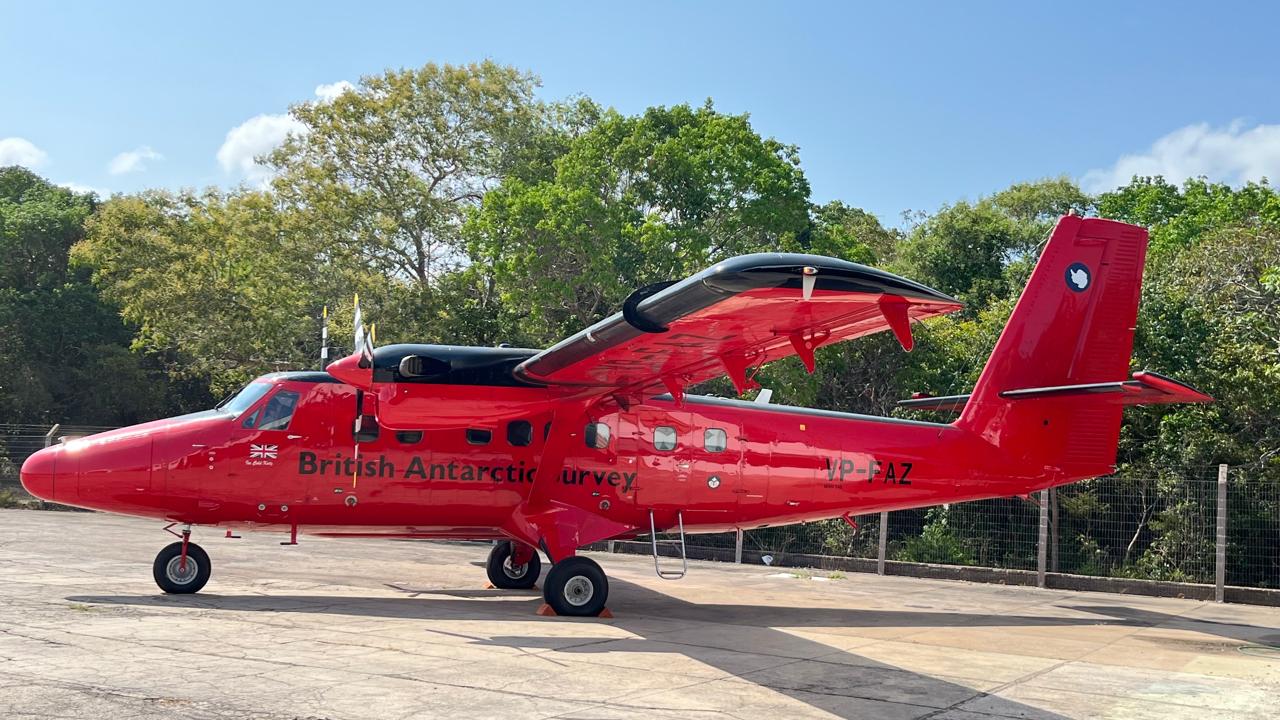
Red twin-engine aircraft parked on the apron, with trees in the background
The Twin Otter in Santarém before its first flight. Photo: Lenne Santos, Ascom/Ufopa.
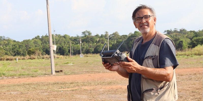
Researcher holding a drone controller in an open area, with the forest in the background
Preparing mobile fire and smoke measurements near Santarém. Photo: ESA, CarbonARA project.
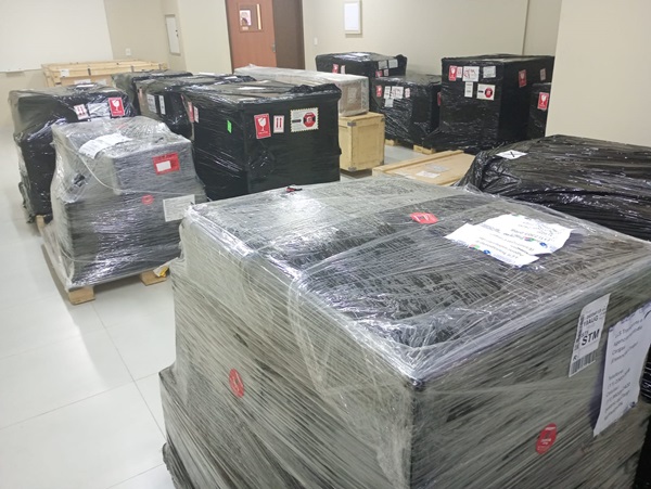
Packed boxes of scientific equipment stacked in a room
Project equipment on arrival at Ufopa. Photo: Ascom/Ufopa.

Progress

Timeline

September 2025
More than three tonnes of equipment, valued at around 30 million reais, arrive at Ufopa. A task force of researchers from Brazil and Europe carries out the assembly.
26 September 2025
First Twin Otter flight from Santarém airport.
October 2025
Installation of the 40 m tower at the Experimental Farm and end of the airborne campaign.
2026
The fixed instruments continue measuring to cover a full cycle of wet and dry seasons.